Explore
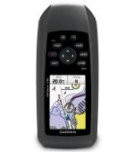
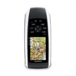
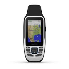
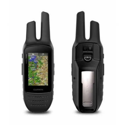
Garmin GPSMAP 78S Navigator comes with a built-in worldwide base map, so you can navigate anywhere with ease. And, like the rest of the 78-series, 78s is water-resistant (IPX7) and even floats in water.
Get Your Bearings
Garmin GPSMAP 78S Navigator has a built-in 3-axis tilt-compensated electronic compass, which shows your heading even when you’re standing still, without holding it level. Its barometric altimeter tracks changes in pressure to pinpoint your precise altitude, and you can even use it to plot barometric pressure over time, which can help you keep an eye on changing weather conditions.
Share Wirelessly
With GPSMAP 78s you can share your waypoints, tracks, routes, and geocaches wirelessly with other compatible device users. Now you can send the location of your favorite fishing spot to a friend to find. Sharing data is easy. Just press “send” to transfer your information to similar units.
Keep Your Fix
With its high-sensitivity, WAAS-enabled GPS receiver, and HotFix satellite prediction, GPSMAP 78s locates your position quickly and precisely and maintains its GPS location even in heavy cover and deep canyons. The advantage is clear — whether you’re in deep woods or just near tall buildings and trees, you can count on GPSMAP 78s to help you find your way when you need it the most.
Add Maps
Adding more maps is easy with our wide array of detailed marine, topographic, and road maps, available on a microSD card. Conveniently plug in BlueChart g2 preloaded cards for a great day on the water or City Navigator NT map data for turn-by-turn routing on roads (see maps tab for compatible maps). The card slot is located inside the water-resistant battery compartment, so you don’t have to worry about getting it wet.
Get Connected
You’ve been busy exploring and now you want to store and analyze your activities. With a simple connection to your computer and to the Internet, you can get a detailed analysis of your activities and send tracks to your outdoor device using Garmin Connect. This one-stop site offers an activity table and allows you to view your activities on a map using Google™ Earth. Explore other routes uploaded by millions of Garmin Connect users and share your experiences on Twitter® and Facebook®. Getting started is easy, so get out there, explore and share.
Find Fun
GPSMAP 78s supports geocaching GPX files for downloading geocaches and details straight to your unit. By going paperless, you’re not only helping the environment but also improving efficiency. Simply upload the GPX file to your unit and start hunting for caches. Slim and lightweight, 78s is the perfect companion for all your outdoor pursuits.
To explore our catalog, please follow us on Garmin GPS Navigators for amazing deals at GrandHub Technologies.